De Levende Natuur nummer 2 van 2019 (English summary)
Afbeelding

Ancient woodland in the province of Overijssel
P. Bremer
In the province of Overijssel (The Netherlands) an Ancient Woodland Inventory (AWI) has been carried out and data made accessible on the site www.atlasoverijssel.nl. 326 woodlands larger than 0,15 ha can be attributed as ancient woodland. Ancient Woodlands are defined as those woodlands already on the Hottingerkaart (ca. 1783) and high AW score, indicating that the majority of these woodlands already existed in 1600. A part of them is even much older. Most ancient woodlands can be found in Twente, but concentrations are found in Zuid-Salland, Vechtdal, Hoge land Vollenhove and Paasloo-Woldberg as well. Within the inventory a special AW scale has been assembled with a scope between 0 – 10. The scale is based on the name of the woodland, the perimeter, whether it is isolated from human settlements (villages, farmsteads), altitudinal variation, soil composition, the composition of the boundary (are there special elements, especially wooden banks), wooden banks within the woodlands, ancient woodland plant indicators, number of woodland communities and the (historical) use as coppiced woodland (or coppice-with-standards). 45% of the woodlands have a name. Some of them are oval, but those with a rectangular form are also found. Except from the category `farmyard woodlands` most are isolated. The soil composition might agree with the aged status of the woodland, but sandy soils can be disturbed due to deep spitting. Wooden banks often delimitate the ancient woodland, but other elements can be relevant as well. The woodland can be divided by inner banks. At average there are 2.6 ancient woodland indicators per ancient woodland. Most species are found in Oak - Hornbeam woodlands, while on nutrient poor sandy soils the numbers can be low. The AW scale varies from 3 to 10, at average 6.7. In 13% of the AW the shape has not changed in the last centuries. 7% of them are protected within the Nature2000 legacy. There are 12 AW groups, with the historical Oak coppice, manor woodlands, maiden tree woodlands and estate related woodlands being most important. Less important are alder brooks, Ash coppice, Pedunculated Oak coppice, Oak - Hornbeam woodlands, riverine woodlands and former grazed woodlands. It is estimated that ca. 25% of the woodlands are primary, the others secondary. All woodlands are protected by law although there has been some loss in the past.
Muskrat ups and downs
D. Bos, E. Wymenga, R.C. Ydenberg & E.E. van Loon
An extensive control programme for muskrat Ondatra zibethicus has been in effect for decades in The Netherlands, because muskrat burrowing can compromise the integrity of dykes and hence poses a public safety threat. To support evidence-based decision-making about muskrat control, field and modelling studies have been undertaken over the past decade. The number of muskrats trapped (as well as the amount of by-catch) has been declining since 2004. Experimental and statistical evidence supports the hypothesis that this can be attributed largely to trapping of sufficient intensity and quality. The field research enabled a basic premise of the control programme to be quantified, namely the relationship between muskrat numbers and damage inflicted. The results made it possible to compare alternative control strategies using criteria such as the number of animals killed over the medium term, the risk of damage to infrastructure, by-catch, and financial costs. The comparison reveals that short-term intense trapping to reduce or even eliminate muskrat numbers has many advantages in the medium and longer terms over alternative strategies. The current situation (low - moderate annual catch) is the result of moderate investment in control over recent decades. We caution against reducing investment further, because the high reproductive potential of muskrats enables them to very quickly produce high numbers.
Water regime as conditioning factor for fritillary hay meadows along the lower course of the Vecht river in the Netherlands
J. Runhaar, B.R. Raterman, T. de Meij & J. Bredenbeek
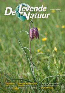
The lower course of the Vecht River, called Zwarte Water, harbours one of the largest populations of the Snake's Head fritillary (Fritillaria meleagris) in western Europe. For that reason, the river banks along the Zwarte Water have been designated as a special protection site under the Habitat Directive for the alluvial hay meadows in which the fritillary occurs. Flooding with river water in the winter period is considered an important prerequisite for the development and conservation of alluvial hay meadows with Snake's Head fritillary. We investigated whether flooding regime and internal water management of the alluvial meadows were in line with the ecological requirements of fritillary hay meadows, and which sites are suited to expand the current area of fritillary hay meadows. In the present situation flooding of the riparian zone is limited by embankments along the river. In the upper reaches of the Zwarte Water breaches in the embankment are sufficient to restore the natural flooding regime. This will be realized in the next few years by the regional administration, after the last agricultural parcels have been bought up. In the lower reaches breaching of the embankments is not a feasible option: because of internal drainage and consequential peat oxidation the soil surface has subsided and breaching will result in permanently flooded sites that are suited for the development of marsh vegetation only. Controlled inlet of river water possibly is an alternative for natural flooding in the lower reaches of the Zwarte Water. However, this requires a better understanding of the ground and surface water regime needed for the development of fritillary hay meadows.
Restoration of reedmarsh in the ‘Rijnstrangen’ by water-level drawdown with sediment exposure
H. Coops & C. Buddingh
The ‘Rijnstrangen’, a former branch of the River Rhine, is an important wetland in the eastern part of the Netherlands owing to the presence of vulnerable marshland breeding bird species such as great reed warbler, bittern and black tern. Because of reedmarsh degradation in recent decades, various local restoration measures have been taken in the past years, including topsoil removal, mowing and transplanting of reed vegetation. In August - October 2016 a water level drawdown in the western part of the area resulted in temporary exposure of a large part of the bottom sediment. Vegetation responded by massive germination of plants, including several species of helophytes and nymphaeids. Biogeochemical sampling showed strong effects of sediment redox conditions, especially on drying-out sediments. Some effects remained after reflooding and were still notable one year later: increased aquatic vegetation cover and reduced sediment nitrogen concentrations. The development of helophytes after reflooding was hampered by grazing, mostly by geese, which was demonstrated in several exclosures that had been set up during the drawdown.

